The Hampton GIS Viewer interface has been designed to provide you with a simple and intuitive web mapping experience that is modeled after popular consumer based web mapping applications. This includes extensive searching capabilities with detailed results, a buttonless interface, seamless panning, scroll-wheel zooming and intuitive search and mark-up tools. The web mapping application is designed to work with all modern web browsers but is optimized for Internet Explorer 7+ and Firefox 3.5+. This help file provides detailed information on all of the core functionality available in the application.
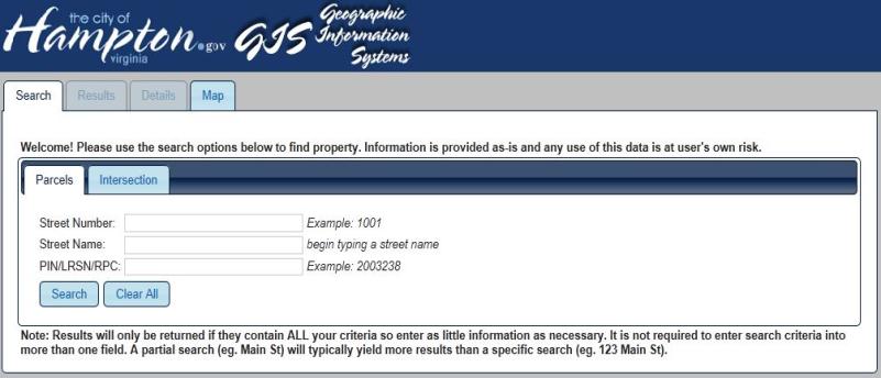
There are four main tabs available in the application: Search, Results, Details, and Map. After clicking the checkbox to accept the disclaimer, the application will open with the Search tab active. With this tab active, searches can be run based on property and sales information which will return a list of matching results from which you can then access detailed information about a selected property. The Results tab will remain inactive until a search is run, and the Details tab will remain inactive until a search result is chosen.
To make navigation within the application easier, users should navigate by clicking back and forth between tabs rather than using the back and forward buttons in the web browser. Using the back and forward buttons will yield unexpected results and will not navigate back and forth between tabs.
Users have the option to click on the Map tab without running a search. This can be useful for users who simply want to view the map and the many available layers or for those who already know the specific location of a property.
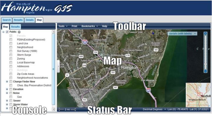
The Web Mapping Application page has four main parts:
• Map: View the current map extent and interactive display for exploring the map.
• Console: Allows the user to turn off and on layers in the map and access results from searches and queries.
◦ Map Layers
◦ Results
• Toolbar: Provides access to the advanced tools available in the application.
• Status Bar: Displays the scale on the map and a real-time display of map coordinates.